
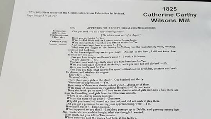
Artists have recorded history of Ireland for a long time and the area where ITB stands is no exception, where we stand today used to be called buzzardstown a long time ago, the area had a lot of forestry and ofc lots of buzzards hence the town name. Believe it or not CDM it’s self has given us the tools to write history ourselves through the use of social media we can show the world what ITB was like over the years. Before the campus grounds were even placed up until 1998 there was an old lady who owned goats and she lived on this land which was situated around where the A block is now. In the 1840’s people had the famine around this area and all they could eat was spuds because everything else was susceptible to dyeing from the disease and we couldn’t afford to import goods. Mostly because back then the currency was land, if you had it you were well off, but who owned the land all these years that we now stand in today called ITB? check picture to the right.
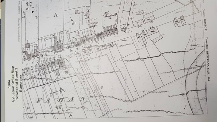
This map of how the college looked back in 1904 and what the surrounding area looked like. The famine was so great that over 2milion people left Ireland because we were all unable to support eachother, it wasn’t until later that things started to stableize. Belfast was the biggest city back then but mostly because of ship building and wars, there was lots of local tanneries which produced leather for soldiers. I often wonder what the area was like and how things were back then. Digital media help tell our history and Ireland brings tourism because of CDM and the story of Dublin. Back then cannals were the best form of transport until the train was invented and because it was so expensive to build cannals they gave up and evuntualy these areas were used to pave the way for my train tracks and railways. And this is all just a short version of the story of ITB and how it all came to be.